Wairere Falls Track
Waikato, Matamata
Opening hook
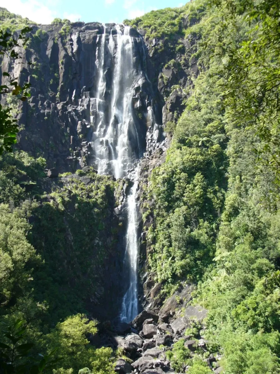
Wairere Falls is one of those places that reminds you how dramatic the Waikato landscape can be. The walk climbs through native forest, crosses a stream on small wooden bridges, and ends at lookouts with wide valley views and a waterfall that drops 153 metres over the Kaimai escarpment. DOC describes it as a steep, rocky track with rockfall risk in some conditions, so it’s as much a proper tramp as it is a scenic outing.
For many visitors, the appeal is simple: you get a big waterfall, native bush, and a memorable viewpoint, all within easy reach of Matamata and Te Aroha. Just keep in mind that track status can change, and WaikatoNZ currently lists the route as closed until further notice due to dangerous rock fall and land movement.
What to See & Do
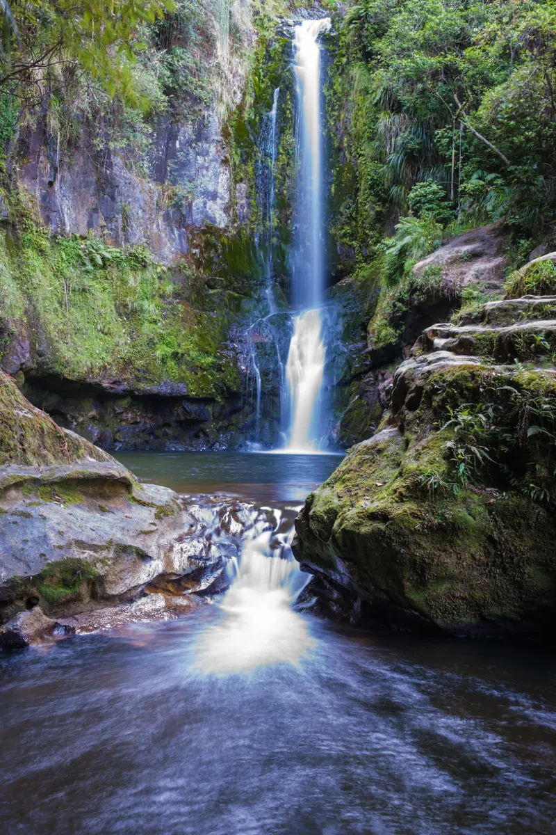
The main reward here is the waterfall itself, which is widely described as the highest in New Zealand's North Island. From the lower lookout, you get a powerful view of the falls as they plunge down the escarpment and break into streamlets over mossy rocks and ferns. If conditions and access allow, the upper lookout gives you a broader perspective over the Waikato valley and plains beyond.
The walk is also appealing for the forest scenery along the way. DOC notes moss-covered rocks, tree roots, nīkau, pūriri, kohekohe, tree ferns and tōtara, while spring brings the apricot-coloured flowers of taurepo on the rocky valley walls. It's a good example of a short New Zealand bush walk that feels varied rather than repetitive.
- >Lower lookout: the first major viewpoint on the track.>Upper lookout: a steeper continuation for wider valley views.>Native bush sections: good for photographing forest textures and streams.>Seasonal detail: spring flowers and wetter winter flow can make the scene especially striking.
History & Significance
Wairere Falls has been recognised as a scenic place for well over a century. DOC and other sources note that the surrounding area was protected as a scenic reserve in 1908, showing that its natural value was understood early on. The falls themselves are tied to the Okauia fault line, which helps explain the steep escarpment and dramatic drop.
The name is also meaningful in a simple, poetic way: 'wai' refers to water and 'rere' to flowing or flying, which suits a waterfall that seems to pour straight out of the cliff face. That sense of movement is part of what makes the place memorable. It’s not just a photo stop; it’s a landscape shaped by geology, native forest, and time.
Wairere Falls is best appreciated as a living landscape rather than just a viewpoint: the forest, rock faces and waterfall all work together to create the experience.
Practical Visitor Information
Access starts from the car park on Goodwin Road off Old Te Aroha Road, south of Te Aroha. DOC describes the walk as 5 km return via the same track, with the lower lookout around 45 minutes one way and the upper section taking about 90 minutes from the lower lookout. WaikatoNZ lists the activity as free, but track conditions matter more than price here.
DOC warns that the cliffs around the track are prone to rockfalls, especially during or after heavy rain, and says the track should not be used in those conditions or during severe weather watches or warnings. The track is steep, muddy and rocky in places, so sturdy boots, warm layers, rain protection, food and water are sensible. If you're travelling with children, keep them well back from edges and stay on the marked route at all times.
- >Track length: 5 km return.>Fitness: moderate fitness recommended.>Footwear: sturdy shoes or tramping boots with good grip.>Hazards: rockfall, slippery rock, steep drops and wet ground.>Dogs: DOC says no dogs unless you have a permit for hunting.
Getting There
Wairere Falls is usually visited from Matamata or Te Aroha, making it a convenient detour on a Waikato road trip. WaikatoNZ says it is about 10 minutes' drive from Matamata, while other local itinerary sources describe it as roughly 15 minutes from the town centre. The last section leads to the Goodwin Road car park, which is signposted from the Te Aroha-Okauia Road.
If you’re coming from Auckland, Hamilton, or Rotorua, it’s easiest to treat Wairere Falls as part of a wider Waikato itinerary rather than a standalone destination. The road approach is straightforward, but the final walk is where the effort comes in. That effort is part of the appeal: you earn the view.
Tips for Visitors
Check the latest DOC alerts before you go, because this track has experienced safety-related closures and upgrades. If the track is open, start early so you have time to walk carefully and enjoy both lookouts without rushing. After rain, it's best to skip the visit entirely because the track can become hazardous very quickly.
A walking pole can help on the descent, especially on the steeper sections and stairs. Pack water, snacks, sunscreen and a rain jacket, even on a fine day, because the weather in the Waikato can change quickly. In spring, look out for seasonal flowers along the valley walls, and in wetter months the falls are often at their most impressive.
Nearby Attractions
Matamata is the most obvious base, and Hobbiton Movie Set is the area’s best-known attraction. Te Aroha is also nearby if you want to combine your visit with a spa town stop or a gentler walk. Kaimai Mamaku Conservation Park offers a broader wilderness setting if you’re building a longer outdoor itinerary.
If you’re planning a fuller day, pair Wairere Falls with lunch in Matamata or a soak in Te Aroha after your hike. That mix of bush, waterfall and small-town stops makes the area feel very Waikato: scenic, practical and easy to enjoy at your own pace.
Accessibility
Not wheelchair accessible. The track is steep, rough, muddy and rocky in places, with steps and staircases on the upper section. DOC says a moderate fitness level is needed, sturdy shoes with good grip are recommended, and the route is not suitable during or after heavy rain. Children should be closely supervised near steep drops.
Opening Hours
Varies by track status. WaikatoNZ currently lists Wairere Falls Track as closed until further notice due to dangerous rock fall and potential land movement. Check DOC alerts before visiting.
Related Attractions
Written by
AdminApr 25, 2026